How Drones are Revolutionizing Wildlife Research in Wildwood
LL
The Advent of Drones in Wildlife Research
In recent years, drones have become an indispensable tool in wildlife research, offering scientists unprecedented access to remote and challenging environments. Particularly in Wildwood, these flying devices are aiding researchers in gathering data that was once difficult, if not impossible, to obtain. By providing aerial views and real-time data collection, drones are transforming the way conservationists and ecologists study wildlife.
Their ability to capture high-resolution images and videos allows researchers to monitor animal populations, track migratory patterns, and assess habitat health without disturbing the natural environment. This non-invasive approach is crucial for studying sensitive species that may be adversely affected by human presence.
Applications of Drones in Wildlife Monitoring
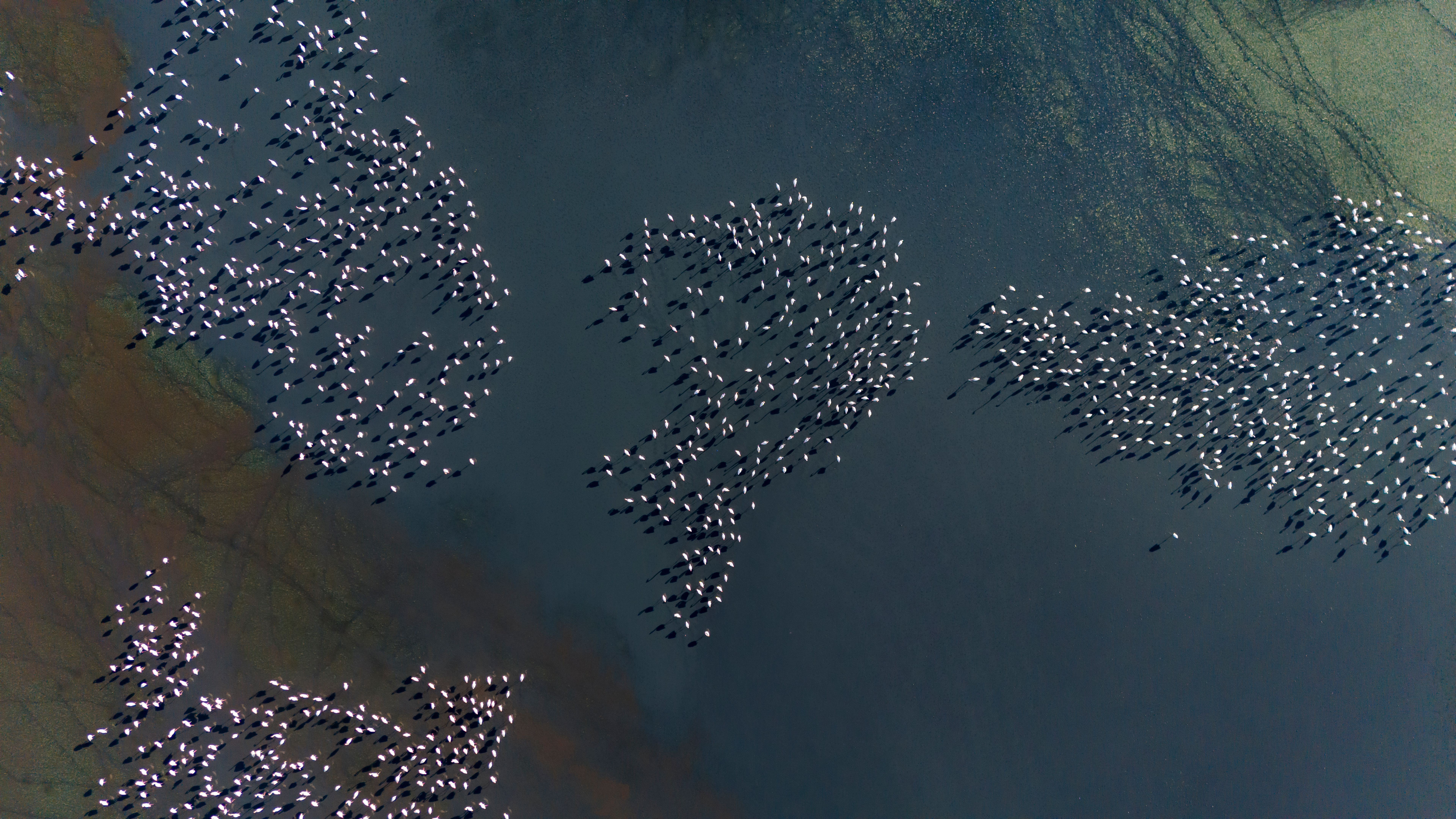
Wildlife monitoring is one of the primary applications of drones. In Wildwood, drones are being used to track endangered species such as the red fox and various bird populations. By flying over large areas quickly and efficiently, drones can cover more ground than traditional methods, providing comprehensive data on animal distribution and behavior.
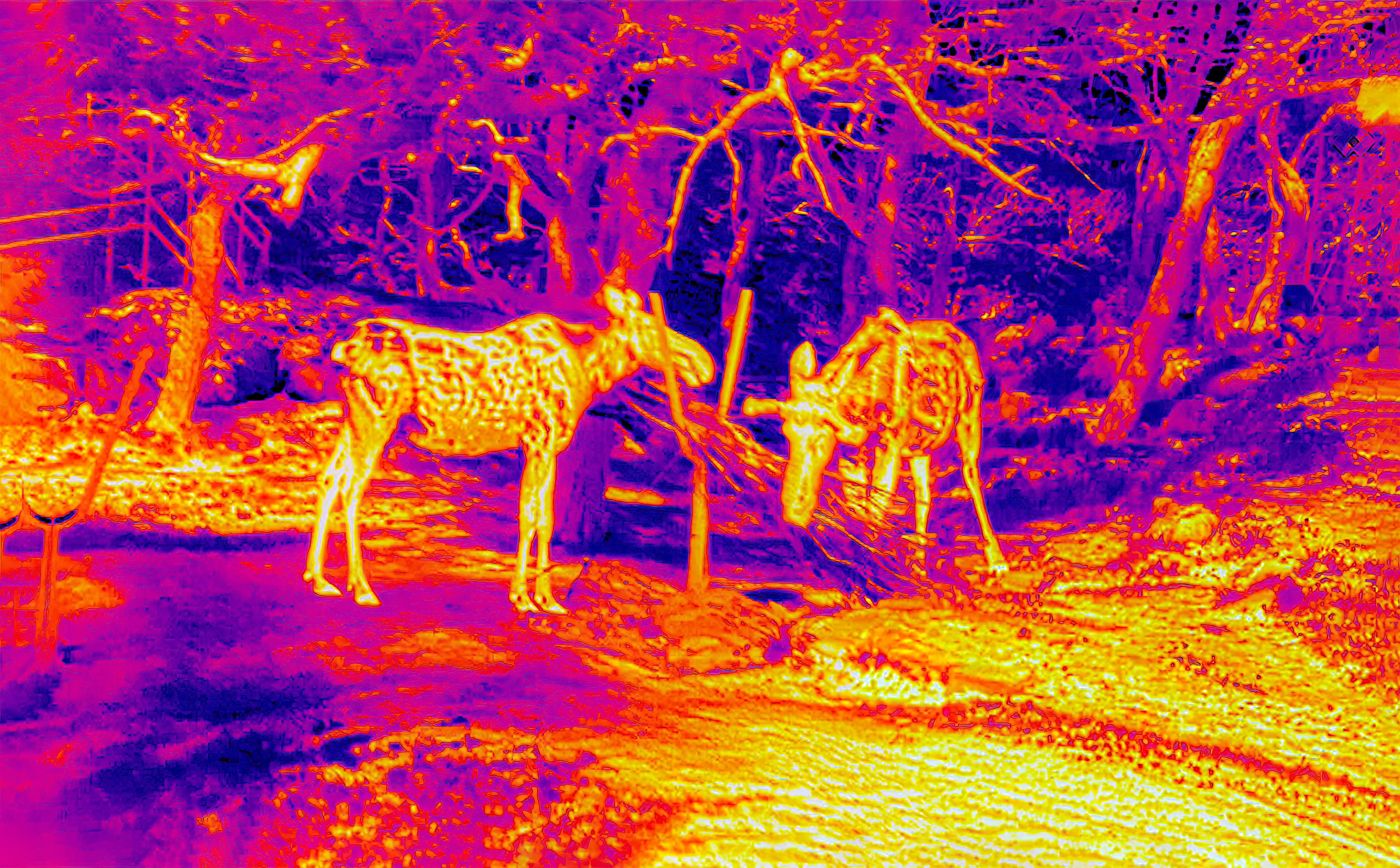
The use of thermal imaging cameras mounted on drones has been particularly impactful. These cameras allow researchers to detect animals in dense vegetation or during nighttime surveys, which would otherwise be challenging with ground-based observations. The ability to collect data around the clock enhances the understanding of nocturnal species and their interactions within ecosystems.
Enhancing Data Accuracy and Speed
Drones also play a critical role in improving the accuracy and speed of data collection. Traditional methods of wildlife research often involve significant time and labor, such as setting up camera traps or conducting manual surveys. With drones, researchers can quickly gather vast amounts of data with minimal effort.
The integration of GPS technology enables precise mapping of habitats and migration routes. This level of accuracy aids in creating detailed models of wildlife movements and habitat use, which are essential for effective conservation planning.
Challenges and Considerations
Despite their advantages, the use of drones in wildlife research comes with its own set of challenges. Regulations regarding drone usage can vary significantly between regions, necessitating careful planning and compliance with local laws. Additionally, there is a need to ensure that drones do not disturb wildlife, which requires skillful operation and ethical considerations.
Researchers must also contend with the limitations of drone technology, such as battery life and weather conditions, which can affect flight duration and data collection. However, ongoing advancements in drone technology are continually addressing these issues, making them more reliable tools for research.
The Future of Drones in Conservation
The future of drones in wildlife research looks promising as technology continues to evolve. With improvements in artificial intelligence and machine learning, drones will be capable of analyzing data autonomously, providing insights at a faster pace than ever before.
As these technologies develop, they hold the potential to revolutionize not just wildlife research but also conservation efforts worldwide. By offering precise, real-time information, drones empower researchers to make informed decisions that can protect and preserve biodiversity for future generations.